Friday 21 October 2016

C2C

So, the C2C, a 140 mile coast to coast tour, no doubt a tour which provides you with a challenge with it’s a route through the Lake District and over the Pennines, while also a route through breathtaking scenery and picturesque towns and villages.

The C2C was the first of the Northern Coast to Coast routes to be set down as an official route on the National Cycle Network, hence the name, and is also a right of passage for many serious and not so serious cyclists. It has two start points, Whitehaven and Workington, and two end points Tynemouth and Sunderland, as well as a few options as you cycle along.

I’m doing this tour with my good friend Paul Pearson, a man who could be likened to a sniffer dog if the dog's job was to find hills and passes and cycle over them. If you can cycle over it anywhere in Europe, Paul has probably done it, he is an expert on the south of Spain and extremely knowledgeable about everywhere else.

So we decide to set off from Whitehaven and finish in Tynemouth staying away from the really rough off-road parts and sticking to road and smoother off-road tracks. We were both arriving by train so we arranged to meet in Carlisle and caught the connecting train to Whitehaven. This was my second trip on this train, and it is an interesting trip – especially as you get closer to Whitehaven and start hugging the coast – it was good to be travelling with Paul discussing our next three days and the route we were taking. Our plan was to be on the road around 1pm and get to our inn for around 6pm that evening. So we stocked up with some goodies in the Tesco beside the station and headed over for our compulsory photo in front of the famous C2C sign in the harbour, which was taken by a very kind lady who offered to take it, and off we went.

The route is really well signposted as you would expect from one of Sustrans flagship routes. After riding through the town the route is off-road for the next 10 miles or so, this part is popular with walkers and local cyclists so you can expect to see other users as you head out of Whitehaven. The off-road along the route is a mixture of hardened grit or tarmac, and is a very good surface for cycling on, and here you rise up slowly to Kirkland giving you impressive views of the fells and lakes below. You slowly descend to Loweswater, which is surrounded by beautiful hills and it is a very pretty place for a picture. Cycling along the edge of Loweswater I wasn’t sure to wear my sunglasses or not, as the sunshine was shimmering through the trees and it kept going from bright sunlight to shade and back again. Halfway down the lake the road takes you away away from Loweswater and further into the Lake District, around two miles later – just about where your bike would come to a natural stop – there is an amazing view to your right of Crummock Water and it’s surrounding peaks including Grasmoor and Whiteside.

Leaving this behind, you set off on the beginning of your first real pass of the tour, Whinlatter Pass. So we first travel through High Orton where you need to follow the yellow diversion signs, and instead of going through Scales Farm you follow the B road running beside it. However before getting to the B road there is a short sharp shock of a hill where Paul left me for dead! My excuse is that Paul had been cycling through the Balkans all summer, a lame excuse – you really know you’ve been left behind when your friend is taking pictures of you from the top as you struggle up, especially when the hill was only a couple of hundred meters in length. Thankfully it all calms down after that, and even though it was a little steep, I was able to hold onto Paul as we made our way up Whinlatter.

Around Whinlatter there are a few rough parts, the not so rough off-road section was closed for tree felling, which meant we had to stay on the road. This suited us me as it had been a quiet and lovely road through the forest to ride. At Whinlatter Visitor Centre we stopped for a late lunch, like most of the forest park visitor centres around the country, it was well kept with great facilities and a ‘Go Ape’ centre. Another good thing is that the centre is on the pass, so after our tesco lunch, it was straight down to Braithwaite – so if you’re like me and get a bit cold after eating you might need to put your jacket back on. There is a MTB advisable section, which we stayed well clear of before shooting off down the hill as fast as my brakes would let me. At the local pub at the bottom of the hill you take a sharp right which takes you away on a small local road towards Derwent Water and Keswick, providing great views of where you have come from as well as where you are going, including the very impressive Skiddaw.

Turning back onto the road to Keswick we spot another tourer coming our way, who turned out was on our train from Carlisle but started in Workington, it also turned out that the off-road sections from Workington were mainly closed so she had to stick to the mainer roads. Keswick is a typical pretty Lake District town with lots of cafes, pubs and restaurants with pedestrianised street, while also being surrounded by beautiful hills and fells making it very popular.

Coming out of Keswick we took the road to Castlerigg Stone Circle which was another short sharp shock to the system, but this time I manage to hold onto Paul until I had to stop to take a photo, always a good way to hide the fact that your starting to blow. The road is well worth it as the stone circle and its surroundings were absolutely outstanding. Actually standing there at sunrise or sunset must be absolutely spectacular, for us there was a bus load of tourists there but still beautiful, you can see how it was a mystical place for the inhabitants at the time it was built. The entrance to the site has some nice circular maps with Castlerigg Stone Circles in the centre surrounded by fells including Blencathra, Skiddaw and Castlerigg Fell. From the stone circle we descend towards Threkald following the foothills of Blencathra. The road here is very narrow and every few hundred meters there’s a gate to open and close, usually just before a little climb. The road continues like this for a couple of miles until it looks like you are doubling back on yourself and start heading back towards Troutbeck

We’re almost done for our first day as our accommodation for the night is a little off route in Penruddock. A nice inn, with comfortable if small rooms, good food and lots of it as well as nice beer (all of which were very welcome). Just before ordering food, one of the locals called us over and asked us something while pointing at a pub game game of some sort, but neither Paul or I had an idea of what he was talking about – given that I’m Irish and Paul is Scottish and neither of us have the softest of accents, and we have both worked as English language teachers in different countries, not being able to understand a word was something else. He did come up to me later and asked (I think) to speak to my wife as I spoke to her on the phone and later still started shouting at me to say potato! I was pretty sure he’d had enough potatoes to be honest. Apart from that it was a great night of food, a few beers and a couple of games of pool, I of course won by getting Paul to pot the white at the same time as he potted the black, quite a skill that one.

So after a good rest we shot off again the next morning. The first town we encounter is Greystoke, made famous by the books and films of Tarzan, a pretty village with distinctive reddish brick houses and a nice centre. Surrounded by Castle Greystoke and private gardens, legend has it all who enter develop a strange baying noise!! Sorry. The road to Penrith is easy riding and includes a detour through a local college to an off-road section to Penrith. The C2C route itself misses on the centre of Penrith but we rode in to take a look around, again it’s a pretty town with lots of eateries and local shops. We stocked up for today in M&S and braced ourselves for the climbing to come today. 

The ride between Penrith and Langwathby was very pretty at this time of the year, a few steep climbs followed by a quick descent through Beacon Fell and Wood Head before we burst out onto a road surrounded by fields of wheat and/or barley. After passing through the small town of Langwathby with it’s cosy couple of cafes you hit a few steep hills. Then the road begins to undulate towards Renwick, look to your right and you can see where you will be pushing your bike up in the not to distant future. From Renwick it’s a bit of a slog all the way up to Hartside cafe, around 4-5 miles. The good thing about it is that every time you stop the view gets better and better – another good thing is that if your friend brings jelly babies for you to scoff down half way. The road to Hartside is half on a local road and half on an A road. The A road was fairly quiet when we went up and every car that went by gave us lots of room, they also seemed to go by as if we were standing still, which we basically were!

We stopped outside the cafe for lunch, there are benches facing the valley below, perfect for lunch as all cyclists seemed to take advantage of after reaching the top. There were a few different types of cyclists who climbed to Hartside, some came up – lunched – and cycled back down, some came up, ate and got into a car waiting for them then, and then us who cycled up, had something to eat and continued down the C2C route. The route continues on the A686 for around 3 miles, slowly descending, giving you amazing views of the moor surrounding you.
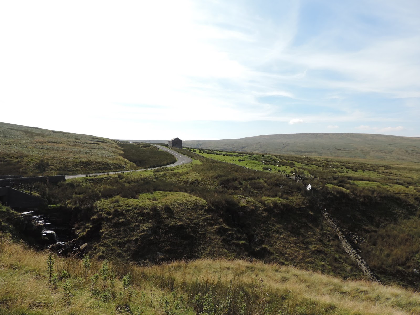
From Leadgate to Garrigil the road is like a roller coaster, up and down, and just too much up to allow you to sprint down and fly up without dropping down the gears (but Paul did try!). Garrigil was like a ghost town passing through, no one around because, as we found out from a couple of cyclists later, was the one day when all shops and cafes close. As we hadn’t planned to stop we kept going. Now, on the C2C map, the road out of Garrigil has no markings showing it as a steep hill, let me tell you – woo- it’s one hell of a steep hill. As we were coming in to Garrigil from Hartside, we were looking for the road coming out as you have a good view of the whole town, but we could only see one road but it looked a bit too mental to be the road we needed to take, so we assumed there was another – there wasn’t. The climb is very steep, not very long, but steep as it climbs across Alston Moor until you can see the town of Nenthead. At this point the road drops steeply into the town so check your brakes. Before you descend you can again check to see where you’re going when you leave Nenthead, this road climbs up Black Hill to the highest point off the NCN.

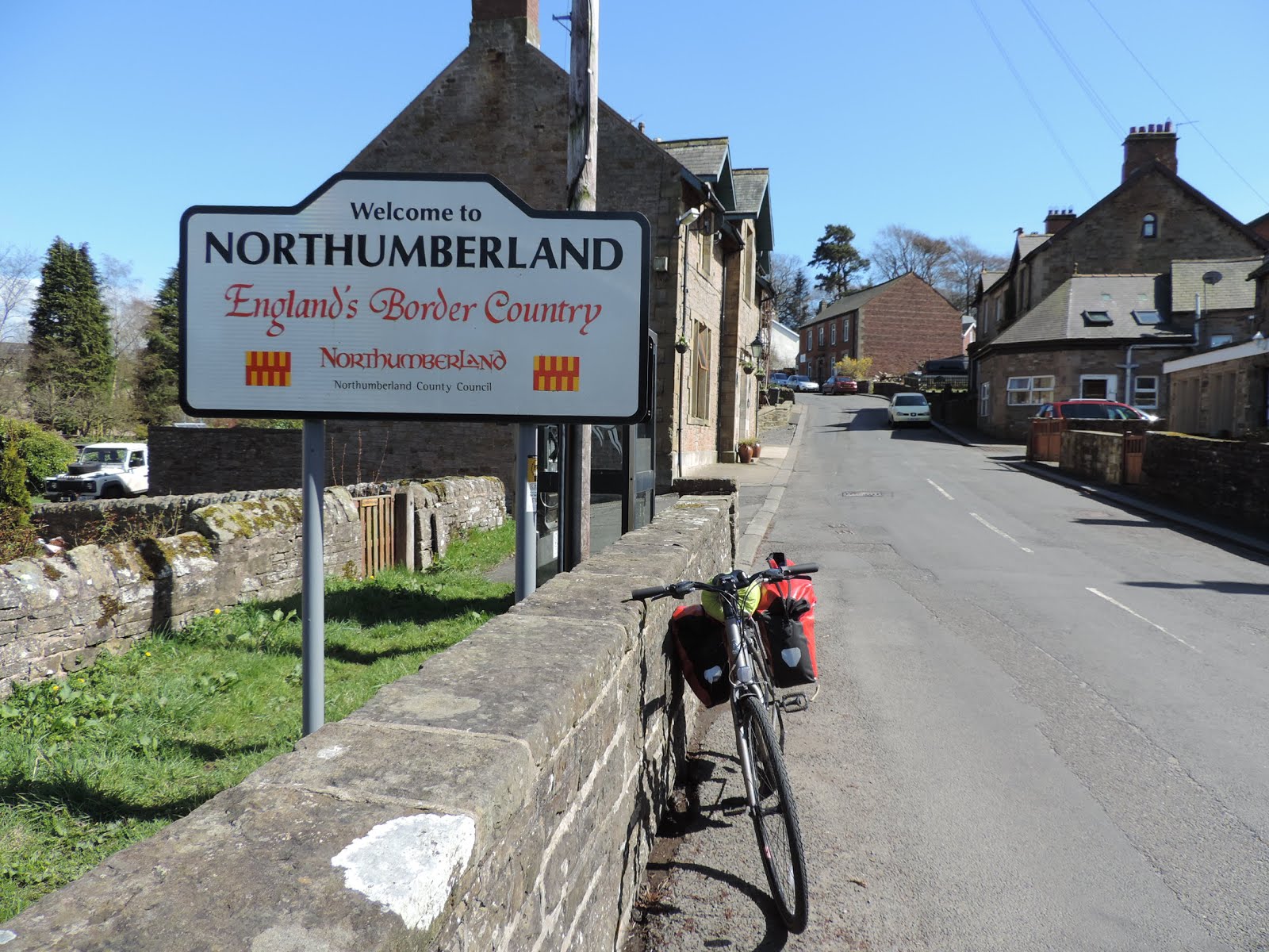
So down and up we go after a quick pit stop in the local shop and a chat to two other c2c-ers, the view from the top is great and not long afterwards you pass the welcome to Northumberland sign. As it’s the top of the NCN you’d think it’s all downhill, and it is all downhill for a mile or so before you climb again! It’s a great ride down to Allenheads, including a couple of cutbacks, lovely views of the road stretching out into the distance. Reaching Allenheads you follow the river into the centre of town, a town sitting in a valley in Northumberland surrounded by Cumbria and Durham, and also a ski centre in winter.

Climbing out of Allenheads you pass quickly into Durham, where after the Durham sign the road softly descends for a number of miles, allowing you to have a nice look around local scenery including the old mine building, now disused. The road continues to Rookhope and again it stays nice and downwards, and weren’t we grateful for the break – although we knew the road out of Stanhope was going to be a slog, especially as we had decided to cycle over almost all of the hills in one day.

So we were enjoying this flat and downward cycle and looking forward to it continuing to Stanhope, as the map says! But NO, maps can lie (or just not tell you the entire truth- and to be fair I find sustrans maps really useful) and up, up we go again! So again we are at the top looking down at Stanhope and looking at the road out of Stanhope. After taking in the views and a handful of jellies we’re off again, free-wheeling our way down to Stanhope.

Stanhope is another pretty village in the mountains, which has a few pubs and cafes scattered around. Just as we turn off to climb up the hill out of Stanhopethere is a lovely village pub with lots of people outside enjoying the summer sun. Looking at this group we were both probably thinking the same thing, oh I’d love a pint!

Completing the C2C in three days isn’t overly difficult, the hills are still to be climbed but it’s spread out – and the hills are what gives the C2C its beauty, and really are a joy to climb. Our mistake, if that’s what you call it it, is that we did it in actually two days (1pm Monday to 1pm Wednesday) and where the two half days were the easier parts – leaving all the major climbing for the one full day. We still enjoyed it immensely and now we started up our last climb of the day and it’s a steep one, and steeper at the start before flattening out the further you go. Half way up I wanted to say to Paul that we’ve it’s back broken, but I needed another jelly baby to say that, so I just looked at him and he nodded in agreement.

So after about 3 miles you get to the cycle path called the Waskerly Way, a beautifully maintained traffic free path, suitable for all bikes, which descends nicely for 10 miles or so all the way to Consett. However, we were staying in Shoteley Bridge, so we figured if we stayed on the road it should take us directly to our hotel, which it did. It was a lovely descent, surrounded by purple heather, with views of Consett in the distance. After a couple of bumps we arrived in Shotely Bridge and our hotel. A nice meal and a few well deserved beers let us relive the day and talk about the morning ahead. The Olympics was showing on the tv and the track cycling was on, I definitely prefer our way of cycling. Talking to the locals about our trip in the morning we hear the famous phrase again -oh it's all downhill.

Fully rested the next morning we leave the hotel, immediately going uphill to the cycle path that will take us to Newcastle and Tynemouth. To be fair, once on the path it was practically all downhill or flat. The path snakes through the forested areas of Chopwell Wood and Snipes Dene Wood along the path known as the Derwent Path, which will eventually lead us to the River Tyne, which we head west along – cross over – then start back west again to Newcastle and Tynemouth. The path at first follows beside a busy road before leaving it and working its way beside the river to the Quayside, Newcastle City Centre and its many bridges. We stopped for a coffee by the Tyne and a few photos by the Millennium Bridge (we’d just missed it operating).

We are now cycling on the route of Hadrian’s Cycleway, Coast and Castles and the C2C and it’s a path I’d ridden recently while finishing Hadrian’s Cycleway. It follows a path through the towns on the outskirts of Newcastle, past Wallsend (at the end of the famous wall!) and North Shields, where you can get a Ferry or a cruise to Northern Europe and Beyond. There is a tunnel where you could cycle through to South Shield, but it’s under renovation and isn’t expected to open until spring 2018, fingers crossed. I think the problem with the tunnel happened when they began renovations and found asbestos, a bit of a headache. However the path now flows around North Shields before the final hill up to Tynemouth and its priory, fish and chips are recommended here (by Jimi Hendrix apparently) but I’m not a battered fish man myself, too much batter not enough fish for me.

So myself and Paul headed back to the train station to meet our trains, we said goodbye, Paul going north while I was heading south. Paul was using this tour as a warm up for his next adventure in Spain, rail-cycling around the north of Spain from Santander into Asturias seeking out hills like Angliru to cycle up! I was only a little jealous.


Thursday 30 June 2016

Hadrian's Cycleway


It's been a few weeks since I've cycled across the frontier cycling route known as Hadrian's Cycleway. It's a coast to coast route stretching from the Irish Sea in the west to the North Sea in the east with a distance between 150 and 170 miles depending on where you start. It has a number of start points including Ravenglass and Whitehaven, while the walking route also has a different beginning point at Bowness-on-Solway. The start points on the east coast stretch southwards giving you opportunities to visit Roman ruins on your way up the Solway Coast. 


I started in Whitehaven, a busy seaside town, and also a starting point for the ultra popular C2C and Reiver's cycling routes, so a town used to seeing groups of cyclists. Unfortunately I was doing this alone, Kay and the wee one were resting up in Glossop. I had been looking forward to doing this tour for a few reasons, one of them being its historical context. Kay and I had spent the previous five years living in Seville, the birthplace of Hadrian – him of the wall. Hadrian was actually born a few miles outside the city in a place called Italica, which house very impressive Roman ruins, and which we have visited, ran past and cycled past on countless times over the five years we spent in Seville. For those visiting Seville, it is definitely a place I'd recommend visiting. It has an amazing amphitheatre where you can walk around and actually visit underneath and see where the gladiators were kept prior to fighting and where also there is a reproduction of the gladiators prayer written in Latin and Spanish. There are also numerous ruins of houses and an interactive museum, it is serviced by a local bus and entry is free to EU citizens. Seville has streets and hotels named after Hadrian (Adriano) so connecting Adriano and Hadrian was something I was looking forward to, that and three days on the bike, Cumbria, Solway Firth, Carlisle, Pennines, the River Tyne, Northumberland, Newcastle and Tynemouth. Overall it is not supposed to be as challenging as the Way of the Roses or the C2C, it's mostly flat on either side with a big bump in the middle going over the Pennines.


I arrived in Whitehaven on the train from Carlisle, it's a very scenic journey and the line hugs the coastline as it makes it way closer to Whitehaven, sometimes slowing to a crawl as the cliffs the train travels over are being reinforced as they attempt to slow down the forces of erosion moving the cliffs backwards. So not exactly a white knuckle ride but interesting nonetheless and you can spot the cyclepath from your window on occasions. After arriving in Whitehaven I realised the both of my memory cards for Virb and my camera were back in Glossop. Luckily there's an Argos in Whitehaven so after making a couple of purchases, off I head following my map and Sustrans well placed signposts numbered NCN 72 with a Roman helmet icon on it. 


The route takes you back past the train station and also hugs the coast for a bit before heading inland and back to the coast to Workington. The weather which had started out a bit dull has started to brighten up and the views across the Solway Firth to Galloway in Scotland are getting better and clearer. Through Workington and over the River Derwent the cycle paths diverge where Hadrian's cycleway continues north along the coast and the C2C heads eastwards inland towards Keswick and the Lake District. So after shedding my jacket and sweater I head north enjoying the cyclepath that will take me all the way to the sleepy seaside town of Allonby, a nice place for an ice-cream as you take in the views across the bay, it's also a place to go for a pee with clean public toilets in the centre of town.


Before Allonby you come to Maryport, a town built around a large marina on the southern tip of the Solway Firth. It also has an aquarium which houses the tourist information centre, and a Roman museum housed in a 19th century naval building and is home to the oldest collection of Roman Artefacts (or so it says) in Britain, and sits next to an old Roman fort from where the artefacts came.

On the way up the coast you start noticing slightly Latin sounding names such as Moota, Aspatria and Cockermouth!, well some sound Latin while others just sound very strange. After Allonby you follow a local road which eventually leads to Silloth, a relatively new town with a slightly American feel about it as it is a planned town based around a grid system. A queue outside a fish and chip shop gives it away as being English as does the cobbled streets rattling the bike as I trudge along the main street. After Silloth the road leads inland for a few miles before again turning north and meeting the Solway coast by the River Wampool near the village of Angerton. From here you follow the head around, past a strange electrical structure on your right and beautiful coast and marshland on your left. Bowness-on-Solway is the next village the road leads you to, the start of the Hadrian's Wall Walk, and it looks directly across the firth at villages in Scotland. From Bowness the road undulates at first before becoming long, straight and flat. This is the end of the road today for me as I stayed in a lovely farm b&b in Boustead Hill, with fabulous views of the Solway Firth after completing around 60 miles today. Hillside Farm B&B is a working farm that has both full bed and breakfast rooms and also a hostel style shared romm that they call camping barns, used mainly by people walking and cycling through the area, it also has a fully equipped kitchen and the people in the dorm rooms can order a cooked breakfast for a small fee. As for dinner, I went off with two lads who were also staying at the B&B. They guys were from Sheffield and worked on old, disused bridges by keeping the vegetation in check and they were also enthusiastic rock climbers. So a curry and a couple of pints later we returned full to the B&B and I returned a little more enlightened about old disused bridges, rock climbing and Sheffield, a very nice night indeed. 


The next morning I'm up early and the sun is out making it a beautiful morning to begin cycling into the Pennines. After a big breakfast I head off down the marshes towards Carlisle. A bit of a longer day today and a bit hillier with a plan to cycle across the Pennines to Ovingham to pitch a tent in the High Hermitage campsite. The first stop is Burgh by Sands, the town where Edward the First died and where a statue of him was placed facing across the firth to Scotland, Edward the First was nicknamed the Hammer of the Scots so make of that what you will. The statue itself is off the official HCW route on a small road that leads towards the firth and marshes. Afterwards the road loops back to connect with the main HCW again and leads us into Carlisle. There is one strange part where you are shown into a little wooded area in which you must push your bike down a series of steps to go under a bridge (there is a groove where you can push your bike, but make sure you keep hold of it as it's steep!) The road will then take you through an industrial estate and into Carlisle proper. It eventually brings you to the castle and here the road intersects with another C2C route called Reivers. The HCW will take you around the back of the castle into Bitts Park where the sign posts will lead you away from the castle as you come back towards it. Make sure you park up the bike or push it around to the front of the castle to take a look at it even if you decide not to go inside. It's an impressive red fortress that has dominated the city skyline for 900 years, and given its proximity to the border has seen its fair share of battles over the years. It also has a Roman connection as it was built on the site of an older Roman fort. From here the bike path leads you into the foothills of the Pennines, no tough climbing yet, just gently rolling hills and passing through small bucolic villages. The road does start getting a bit bumpier and the first biggish town you get to is Brompton. It's a town with a nice centre and a well informed Tourist Information Centre, and a nice place to stop for some lunch which I did – sandwiches and pork pies, the lunch of champions but as there were no champions about it was left to me to eat them.


The man working in the TIC told me that me that the road starts more of an upward trajectory but still had its descents, and that Lanercost Priory was just a few miles down the road with a long stretch of Hadrian's Wall, the first we come across, a little further on. I really enjoyed the priory, it costs £4.10 to enter but is free to English Heritage members. There are quite a few heritage sites across the route each with it's own cost and each needing more than an hour to see it properly, so therefore before deciding which ones to visit you will have to budget your time as well as your money. The church itself was enough for me. The church and the history of the Priory are fascinating and the interior of the church on a sunny day is spectacular, especially when the priory ruins outside are lit up through the stained glass windows. There's also a tea shop (there always is in these types of places) to sit and have a wonder.


After Lanercost the road climbs to Birdsowald – a Roman fort where just before we find the ruins of the wall. It's a great feeling to actually see and you can see why they built it where they did – the views are great north and south, and we all know how the Romans loved a good view. The wall itself was small and not so much a wall to stop people getting in but as a warning that here begins the Roman empire, as in what the Great Wall of China was used for, in my absolutely non expert view (so not what George R Martin was thinking of when he wrote the Game of Thrones). Along the wall there are square ruins of lookout posts and dwelling areas with lots of info for what they were used for. 


Birdsowald is the first in a number of Roman interest heritage sites that can be visited between here and Tynemouth including the Roman Army Museum a few miles down the road, Vindolanda - a newish excavated site sitting near to the highest point of the tour, Housesteads Roman fort a little further on, and there are two more forts just outside Newcastle; Segedunum and Arbeia.


Cracking on but stopping to take pictures every too often I make it to Gisland on the border between Cumbria and Northumberland where I stopped for a snack and a breather on the bridge between both counties and wondered where I was? From Gisland the road took me to Haltwhistle a town which advertises itself as the centre of Britain, and which also has a lot of its own history. With its proximity to the border it had to endure raids by reiver parties, as many towns on both sides of the border did, for centuries. There are many tales and legends of the border reivers and reiving famalies, and some of the old houses in the town were built with reiving money. Haltwhistle was also great for another pitstop/second lunch which I had outside the public park in the centre of town in the company of some locals out enjoying the sunshine.


After leaving Haltwhistle I followed the train line for a bit before climbing again to Once Brewed, with it's iconic sycamore gap (you'll probably have seen it many pictures) waiting to be photograped, after which I turned back towards Vindolanda (they're very close together – instead of turning off for Vindolanda you keep going for half a mile) and its Roman ruins. Leaving Vindolanda the road drops quickly before rising again just as fast. As you rise if you turn around you get great views of the excavation site below you. A little further on you reach a sign saying it's all downhill from here (it doesn't actually say that, it's what a lady in Vindolanda told me and I laugh/don't like/hate it when people say this to me because it's never true and there is usually a few steep hills that people forget about because they drive the route. But in fairness she was right, it was all downhill, almost! The sign says you are now at the highest point of the tour.) and the road gently falls for a while before picking up speed and eventually slowing down as you reach the River Tyne, my guide for the next day or so.


The bike path brings you into Hexham, which when looking around somehow reminded me of cycling in Canada. A big river flowing through it, timber industry and the smell that comes with it, the surrounding forest and possibly the good weather; I'd also just cycled fully loaded over the Pennines and I was a bit tired so it could have also been that. From Hexham I was now starting to zone in mentally and physically on my quarry, Ovingham and dinner. You first pass through Corbridge, a beautifully picturesque town which needed more time than I had to explore but my goal was calling me, but is definitely on the list for the future. From Corbridge the road leads away from the Tyne before again rejoining it near enough to Ovingham. This area was hit badly by the recent floods which meant our road was closed to all traffic except pedestrians and cyclists, great for me this time. However, it is in flux and the situation might change again where the whole road is closed (they need to fix it) and you may be diverted. 


Not long after, I arrive in Ovingham and it's only another mile down the road to the High Hermitage Campsite. Tent goes up, quick shower and I'm ready for some grub. Now comes the big question: Walk or cycle?! I'm too hungry to think which is the best option, so grab the lock, lights and bike and cycle. The white Swan is welcome sight, I order beer, food and I call Kay. Oh the joy of eating after a long day on the bike, it's hard for anything to compare to it and it's a pure high produced by your body burning and storing fuel, and a pint or two is just the icing on the cake (actual icing on an actual cake could also produce the same function!)


There's a pub quiz starting so I go to leave before I embarrass myself. But before I get to the door, they ask the first question: “Who is the boss of Ryanair?” The couple that are sat at my table couldn't remember his name, so I gave them a little help and then made my exit. It was most likely the only question I would have known, but I left with a 100% record, and that's all you can hope for! So with Richard Branson after getting strangers a point, I set off for my night curled up in a tent. 


Third and final day of Hadrian's Cycleway and it was a gorgeous one, albeit a slightly chilly one to start with. So off I head on the road to Wylam to jump of the trail again. Today is basically an easy and flat ride, which follows the River Tyne to Tynemouth and the North Sea. However, first you have to cycle through Newcastle. The trail to Newcastle alongside the river is very pleasant, lots of parks and greenery along with the River Tyne being glorious in the spring sunshine. Just outside Wylam on the trail, you come across the museum of George Stephenson's birthplace, the railway pioneer. The trail continues through the parks banking the river Tyne which look great for a run, walk or cycle, until you come to the edge of the city. The trail now follows cyclepaths/footpaths to Newcastle quayside crossing some bigger roads but all with traffic lights to allow you to cross safely. Newcastle was probably the most surprising part of the tour, riding through the quayside with all those beautiful bridges and buildings, I thought it looked absolutely spectacular in the morning sun. The quayside was littered with cafés frequented by people enjoying their morning coffee at the tables outside; it looked like a chic European city. Later when I returned to get the train back, I got to discover a bit more of the city centre to walk around, and a place I plan to return to again. 


From here, the trail joins the 'Coast and Castles' trail, one which lead from Newcastle to Tynemouth up the coast across the border to Scotland before heading inland to the Scottish capital of Edinburgh.
The trail is very well sign-posted and it flows through the different towns surrounding Newcastle, including Wallsend, which, as its name suggests, is the end of Hadrian's Wall. There was an original section of the wall there and museum/fort called Segedunum. From Wallsend I reached North Shields where I passed through a park to come into the town. Now, Hadrian's Cycleway actually has two endings: South Shields and Tynemouth. It used to be that you could reach South Shields by the tunnel connecting it to North Shields, but at this time the tunnel was under reconstruction so the only way to get there was by pedestrian ferry which left every 30 minutes and takes seven minutes to cross. South Shields also has the Arbeia Roman Fort.


I was heading towards Tynemouth rather than South Shields, so I cycled on through North Shields and onto the coastal path which followed the coast around before climbing up and around toward my destination… and oh, what a sight it was! A picturesque town centre facing the beautiful Tynemouth Castle and all surrounding by majestic cliffs jutting out from the golden sands and the North Sea. 


So it was here that Hadrian's cycleway tour finished for me and it was time for a bit of lunch. Dotted around the square were benches with people eating fish 'n' chips. Now, I'm not normally a fan, but the smell got the better of me so I followed my nose to find a local 'chippy'. On the door it stated that Jimmy Hendrix once ordered takeaway from here, and ate it overlooking the coast and castle. If it's good enough for Jimmy, that will do me. So after a fish and chips that smelled better than it tasted, surrounded by lovely views, thinking back on the previous 2 ½ days, I headed back to Newcastle train station to catch the 3 o'clock back to Manchester. 


Monday 16 May 2016

Way of the Roses

Way of the Roses, March 2016


So this is our first blog, I'm Shane and my wife is Kay, and after more than a decade of cycle touring around the world (whenever we had the chance) we have decided to set up a touring company right here in the UK. This has been a dream for us for a few years but the process was fast-tracked after the birth of our daughter. We are now settled in Glossop in the Peak District, giving us ample opportunity to explore the amazing countryside surrounding us – in between nappy changes, feeds, sleeps, etc. So ya, we moved house/country, had a baby and set up a business all at the same time. Thank heavens for cycling (and running, we're both long distance runners – it helps with perspective, sometimes!). So basically we organise guided day tours and multi-day tours in the Peak District and elsewhere in the UK and further afield.

In this first blog I'd like to talk about elsewhere in the UK and this particular elsewhere being the coast to coast tour known as the Way of the Roses. As we offer it as one of our cycling holidays we went up there to check out the route and meet some hoteliers and B&Bs.
For those of you who don't know of the Way of the Roses, it is a 170 mile 273 km route that stretches from Morecambe on the Irish Sea to Bridlington on the North Sea. The route was developed by the excellent sustrans organisations (a charity promoting sustainable transport – walking and cycling) and opened in 2010. It quickly gained in popularity and has become an iconic route in its own right. Its popularity comes from its setting and the places it travels through such as the Forest of Bowland, the Yorkshire Dales, Nidderdale, the Yorkshire Wolds and cities like Lancaster and York – cites of great historical importance and great beauty. Its name is derived from an ancient war between the house of Lancaster and its red rose, and the house of York and its white rose, the war famously known as the War of the Roses. Thankfully that's all forgotten now, leaving us free to wander through the counties of Yorkshire and Lancashire.

Well this leaves us at the start of the trip, Morecambe, and ready to head off. Normally we would head off together chatting about whatever takes our fancy, but that was all pre breastfeeding and nappy changes. Now as the three of us were crossing the country and the wee one is still a bit too small for a bike seat, someone would have to drive! So this is what we worked out, as Kay had most of the baby feeding equipment she would do most of the driving and visiting of b&bs and I would meet her at lunchtime where we would swap roles for an hour or two when Kay would get to cycle for an hour or two. Afterwards we would meet again and swap roles again, sounds fair enough to me! We decided to take three days to complete the tour, spending a night in Grassington in the Yorkshire Dales and in York.

Arriving in Morecambe it looked like we'd picked a cracking day to start with gorgeous blue skies and only a little chill in the air. After the compulsory pictures in front of the departure sign I head off. Straight away there is a choice, either head directly through Morecambe town to Lancaster or follow the coast for a couple of miles before jumping onto the Lancaster canal. I dunno about you but there's something really nice about cycling on tow paths beside a canal with narrowboats slowly chugging by, also the views across the Morecambe were gorgeous with the snow capped peaks of the Lake District standing out in front of the clear blue sky, so I choose that way.

So it's a few days later and I'm on the train heading for Whitehaven, today I'm starting to ride across Hadrian's Cycleway – a route acrosss the UNESCO heritage that is Hadrian's Wall. I'm trying to multi-task here, looking back at the Way of the Roses while looking forward to the ride across the old Roman frontier. The train also passes through Lancaster, so a helpful reminder of our tour a couple of weeks ago.


The Lancaster Canal is a very pretty peaceful path that winds its way to Lancaster via the Lune Aqueduct. The Lune Aqueduct is a beautiful piece of engineering, taking the canal 664 feet across the River Lune at a height of 61ft. Here you drop down to the river and choose whether to follow the river north or take a quick detour to Lancaster before doubling back. Its a slight pity that Lancaster is so close to the start point as do get that feeling that you'd like to push on. Having said that it's highly, recommended to visit this old red rose city, especially its castle which is still owned by the Queen. As we'd been before we headed directly north on the Lune Valley Trail, a beautiful ride on this sunny March morning as it winds it way beside the river up to the up to the Crook O' Lune bridge and the Forest of Bowland. Here the Way of the Roses leaves the Lune river and it's a perfect spot for a photograph and a popular spot for picnics and walkers. There are diversion signs here for cyclists to avoid going over the Loyn Bridge taking you into Hornby, but happily all repairs have been finished in the past week so we can all enjoy crossing the old Lancashire landmark and not too soon for the local businesses in Hornby. The bridge was barricaded by bags of rocks making it impossible for motorised vehicles to pass over and difficult for everyone else, so said the local barman. The ride to Hornby is very nice, you begin climbing into the Forest of Bowland and as you get higher, looking to your left gives great views of the Lake District in the distance.

In Hornby Kay and myself swapped roles and while I had lunch she set off towards Clapham through the remainder of the Forest of Bowland. Myself and my daughter drive this part of the road after something to eat for both of us and a cup of coffee in the local pub. It's a lovely narrow winding road that leads to Clapham and to the edge of the Yorkshire Dales, but it goes by so quickly it's hard to take it all in even though I was driving at a snail's pace. 


From Clapham it's me again, and from there to Ripon is the bumpiest part of the route, climbing up and over the Dales and Nidderdale AONB before descending into Ripon and following the River Ouse to York. The Dales are beautifully craggy and ancient but in March there was new life everywhere with fields full of lamb finding their feet for the first time, so cute and giving food for thought on that Sunday Roast (see what I did there, apologies!) Leaving Settle you have the steepest climb of the tour, beginning on cobbles (thought I was back in Seville for a second) before turning into a 20% climb for a mile or so, I can imagine people staying in Settle tackling this climb in the morning on a full Yorkshire breakfast (why is it so hard to refuse a cooked breakfast, at least there was no lamb involved). But the climb is worth it, stunning scenery as you climb up, rocky outcrops on either side of you before the landscape levels out and you have uninterrupted views of the Dales in front of you. Here is where you might meet some of the horned Highland Cattle grazing on the road in front of you, great material for a photograph or two. We stopped off in the Grassington Lodge for the night, a lovely guesthouse in the centre of town. After a wash we headed to the local pub for some nosh and I had a pint of the local beer, good times, sleepy times. A quick note, passing through Cumbria now on the train, impressive slopes on either side of the train carriage and loads more spring lambs.


It's a couple of days since finishing the Hadrian's Wall Cycleway, a glorious three days of weather, landscape and history, but more of that later. Leaving Grassington was a little chilly with fog rolling in. The hills were also rolling through Burnsall and Appletreewick which quickly took the chill out of the air. After Appletreewick the road rises up to its highest point of the tour, leaves the Yorkshire Dales and enters Nidderedale AONB around Greenhow Hill Village, the famous village with the famous descent. As I approach the village I can barley see 20 meters in front of me beacause the thickness of the fog, with cars headlights emerging out of the fog not far enough away from me and I'm thinking to myself that I'll have to take this one easy. Leaving Greenhow Hill village I see a slither of blue sky ahead of me and before I know it I can see for miles ahead and I've brioken through the fog, just in time for the descent. It's a good time to remind people that lights and proper reflective clothing can be necessary up here, even during the heights of summer! Greenhow Hill is steep and long, just what you need after a long climb, but it can be dangerous because of it steepness and the amount of turns involved. There is a guide (pdf) to descending it on wayoftheroses.info and you can also watch videos of people descending it on youtube, including mine here. The ease with which you pick up speed is exhilarating after the climb, but be careful as those corners and turns can catch out the most experienced of cyclists. It's a great descent overall though and when I got down to Pateley Bridge my fingers were as cold as ice (gloves!). 


Kay took over from me in Pateley Bridge and I got to take my daughter round the picturesque town in the heart of Nidderedale before having a nice cup of tea. Kay's journey took her from Pateley Bridge up Brimham Rocks before descending into Ripon. I drove into the National Trust site and it is without a doubt worth a visit if you're passing by with its weird balancing rock formations, they look similar to pictures you see of the stones and rocks that people have balanced as art close to popular beaches, but naturally formed and massive in comparison. In Ripon we park up and wait for Kay with a few sandwiches and chocolate. Kay comes around the corner elated and with a big smile on her face, she loved the route.

My turn again, so off I went on the trail to York. The road is instantly noticeably different as it's flat, flat, flat and we follow the River Ouse down through Boroughbridge and Great Ouseburn before following the river into York. It's a tremendous traffic free path all the way into the centre of the city, passing river boats, walkers and runners, and with the famous York Minister emerging from north hand side of the river. As you get into the centre you get to see a really beautiful picturesque village, full of history, a place where you could spend a lot of time wandering around a very touristic city. Kay has mentioned to me since then that if we ever decide to live in a city again that York would be a front runner. I came up from the river path at Station Road and head to Blossom Street to our b&b for the night, The Ashberry, where Kay is waiting for me with a cup of tea. Another great b&b and we have a lovely chat with Steve and Sara - the owners - that evening and in the morning during breakfast.


That night we went to a really nice cosy Thai restaurant on Micklegate but unfortunately we had to bail out before the food came as our little one's tooth started to cause herself a little guff and she decided to let everyone in the restaurant know this, and those on the street and possibly the neighbouring buildings. So back to the room in our b&b with a Thai takeaway for us, everyone gave us ah looks as we left but most likely thinking thank heavens they've gone. Back at the b&b we got plates and cutlery from Steve, put the little one to bed and ate our dinner by street light; rock 'n' roll.

The next morning I cycle to the Minister and it is very impressive, after a quick look inside (you need to book a tour in advance) I head off through this beautiful walled city. The route, which runs beside the Minister, leads first to Stamford Bridge, a picturesque Yorkshire town as well as the name of a famous London football stadium. From Stamford Bridge you follow quiet and relaxing country lanes to Pocklington. After Pocklington you climb into the Yorkshire Wolds and almost immediately I'm in Millington and it's Kay's turn. I hang around Millington for a bit with my daughter, it's a small bucolic village on the edge of the wolds and could be on the edge of the world it was so calm and tranquil when we were there. After following Kay I find myself driving in a valley with gorge like features with steep banks on either side of a very narrow road. I pass Kay and she says to me, beaming, "I really picked the right part to cycle today" and she did. Jealously, I head off to our meeting point which was Hutton Cranswick, a little town about 5 miles outside Driffield. 


So after we do our final swap on this tour I head off towards Driffield following small trails, lanes and country roads. On the way you cross a couple of train lines, it is a good idea to follow the warnings 'look and listen', I myself did but probably not enough the first line I crossed. As I came up to the level crossing a train flew past right to left, so I got to gate and pushed my bike through, looked up and saw the train that had past a good bit up the line so I started to cross. Halfway across I looked up again and saw the same train a lot closer, obviously it was a different train and the first one that passed was long gone from view when I'd got to the crossing, so I crossed the line a bit faster than I had being. Still with 'lots' of time I got to the other side when the train passed me and gave me blast of his horn. Off I headed again towards Driffield with a ringing in my ears, and look-listen-look going through my mind.

Driffield is a big enough market town that had an open air market on the main street as I passed through. You continue on through lanes and paths until you get to Burton Agnes where you cross the A614 across from Burton Agnes Hall. Here I rose up again into the Yorkshire Wolds, as you rise up through pastoral land you get your first view of your quarry and destination below, Bridlington. After dropping into Bridlington, you get that euphoric feeling of having accomplished something, then it takes so long to get through Bridlington, at the end you start feeling like come on. But you finally get to the coast and it is an amazing feeling, and a little bit of sadness it's over even though it was only a few days. It could be hunger as well. A nice town and coastline which was in full swing of celebrations when we were there as it was St. Patrick's Day, lots of people dressed in green and Guinness hats. I see the sign for the finish line, cycle up to it, and ask a lady to take a picture of me, lock my bike on top of my car which is conveniently parked beside the finish point, then head off to the pub to find my two ladies before we head back down the M1 to the Peak District and Glossop where we celebrated with a beer and a glass of wine, once the young one was asleep.

If you'd like to check out our cycling tours here's our homepage www.openroadopenskies.co.uk
Here is our Way of the Roses